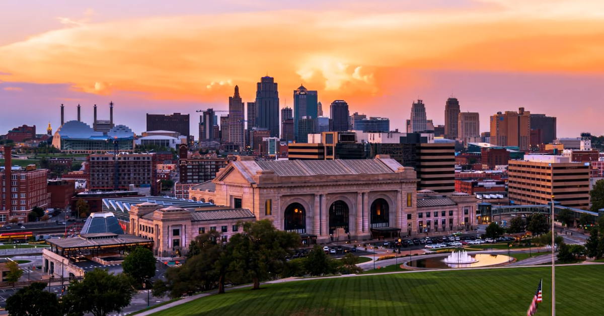

Kansas City went through one of its strangest weather stretches in years this March, and the headline was simple enough: the city hit 93 degrees at Kansas City International Airport on Saturday, March 21, and that reading officially became the hottest temperature ever recorded in Kansas City during March.
The National Weather Service confirmed the 93-degree high, and local reporting noted that it broke the old March record of 91 degrees set back in 1907, which had stood for 119 years.
Just one day earlier, Friday, March 20, had already set a new daily record and marked the earliest day of the year Kansas City had reached 90 degrees since recordkeeping began in 1888, which made the weekend feel less like a normal spring warmup and more like a full seasonal jump.
What made the record stand out was not only the number, but how abruptly it arrived. KCTV tracked the same weather site from one end of the week to the other and showed just how extreme the swing was: last Monday morning, the airport recorded a wind chill of -11 degrees, and by Saturday afternoon that same location had reached 93 degrees, a difference of 104 degrees in what felt like a single weather cycle.
That kind of shift is hard to ignore because it changes the way people move through the day, from the clothes they wear to whether they can even plan to be outside for long.
It also tells you something important about the atmosphere above the city, because swings that large usually mean Kansas City is sitting in a pattern that has become unstable, fast-moving, and unusually warm for the time of year.
This March heat also made more sense once the broader winter pattern was looked at closely. Axios reported that Kansas City had already been running warm for a while, with February temperatures coming in 9.2 degrees above average, roughly four fewer days below freezing, and about six fewer inches of snow than usual.
The winter as a whole was unusually mild too, with December through February averaging around 36 degrees in several metro counties, which placed the season among the warmest on record in some parts of the region.
That matters because a warm winter does not just feel different in the moment; it often sets the stage for early spring warmth by leaving the ground, the air, and the seasonal cycle already ahead of schedule before March even gets going.
Once that early warmth arrived, it started showing up in ways people could see, not just measure. Axios noted that plants were getting a head start on pollen production, and that the early warming was likely to produce a longer and often more intense allergy season.
The same report pointed out that Bradford pear trees and other spring bloomers were opening earlier than they had the year before, which is exactly the kind of everyday sign that tells you the season has shifted before the calendar says it should.
That is why this heat wave was more than a weather curiosity. It changed what people were seeing on sidewalks, in yards, and along roadsides, and it created one of those moments where the temperature, the landscape, and the timing of the year all felt out of step with one another.
The heat also came with practical concerns that made it more serious than just an unusual spring warmup. Local KCTV coverage said a cold front was expected to bring relief, but not before conditions on Sunday created a fire danger strong enough that forecasters warned people to hold off on any kind of burning.
The same report said wind gusts could reach 40 mph as the front moved through, which would make the dry warmth even more problematic.
On the National Weather Service side, the Kansas City office’s text repository showed active fire products for the same period, including a Fire Weather Watch or Red Flag Warning and a Grassland Fire Danger Index update, which supports the idea that the weekend warmth was being treated seriously by forecasters rather than casually dismissed as just a nice spell of weather.
That combination of heat, wind, and dryness is exactly why the record mattered beyond the temperature itself. A city can handle a warm afternoon, but when temperatures spike while the air dries out and winds pick up, the risk profile changes fast.
That is especially true in late March, when people expect some spring warmth but not a level of heat that behaves more like summer. Kansas City’s weather office had already been warning that record warmth was likely in the days leading up to the weekend, and KCTV’s forecasts showed the city moving from one day of record-rivaling heat into another, then into a cooler and windier pattern once the front passed.
The temperature was the story, but the bigger weather story was the sequence around it: warming, breaking records, then cooling sharply, all while fire danger remained in the background.
Even the official weather record context makes the event look more unusual. The National Weather Service notes that Kansas City International Airport has been the official observation site since 1972, which means the 93-degree reading is tied to the city’s long-term climate record and not to a temporary or inconsistent source.
That is important because record-setting temperature claims can sometimes sound dramatic without meaning much, but this one fits into a documented, official record system.
KSHB also pointed out that the earliest previous date Kansas City had ever hit 93 degrees was April 29, 1910, which shows how early this year’s heat arrived compared with the city’s historical pattern. In that sense, the record was not just hotter than before; it was earlier than Kansas City’s own past had ever seen for that level of heat.
The result is a weather story that is easy to summarize and harder to ignore. Kansas City did not simply get a warm afternoon in March.
It came out of a warm winter, shifted into an early spring pattern, tied and broke daily records, then reached 93 degrees to set a new March benchmark that had lasted 119 years. At the same time, the city went from freezing wind chills to near-summer heat in less than a week, then had to deal with fire danger and a fast-moving cold front almost immediately afterward.
That is why the weekend felt so extreme to people living through it. It was not one isolated hot day, but a full weather swing that affected the calendar, the landscape, and the daily routine all at once.
For now, the record will stand as the defining weather story of Kansas City’s March 2026. The temperature itself was high enough to rewrite the record book, but the real story was how complete the shift was: winter-like cold at the start of the week, record heat by the end, early blooming already underway, and a fire-weather concern sitting right alongside the warmth.
That is what made this more than a sunny weekend. It was a clear sign that spring arrived early, fast, and with enough force to leave a century-old record behind.